Published ~ 20 January 2024

Dial Before You Dig!

Finding The Pipes Before You Dig!

Underground pipes play a crucial role in our everyday lives, carrying essential utilities such as water, gas, and sewage. However, locating these buried pipes can be a challenging task, often requiring specialised equipment and expertise. In this article, we'll explore the types of underground pipes, the importance of calling a professional underground pipe locator, and the benefits of enlisting the services of Pulse Locating Services.


Types of Underground Pipes


Water Pipes: These pipes transport potable water from treatment plants to homes, businesses, and other facilities. Water pipes may be made of various materials, including PVC, copper, and galvanised steel.


Gas Pipes: Gas pipes deliver natural gas or propane to residential and commercial buildings for heating, cooking, and other purposes. These pipes are typically made of materials such as steel or polyethylene.


Sewer Pipes: Sewer pipes carry wastewater from buildings to treatment plants or septic systems. They are commonly constructed from materials like PVC, clay, or cast iron.


Why Call a Professional Underground Pipe Locator


Locating underground pipes is not a task to be taken lightly. Here's why property owners should consider hiring a professional underground pipe locator like Pulse Locating Services:


Safety: Excavating blindly without knowing the precise location of underground pipes can pose serious safety risks. Accidentally striking a gas or water line can result in hazardous leaks, property damage, and potential injury or loss of life.


Accuracy: Professional pipe locators use advanced equipment and techniques to accurately identify the location and depth of underground pipes. This precision minimises the risk of damaging existing infrastructure during construction or excavation projects.


Efficiency: Attempting to locate underground pipes without specialised training and equipment can be time-consuming and ineffective. Professional pipe locators streamline the process, saving property owners valuable time and resources.


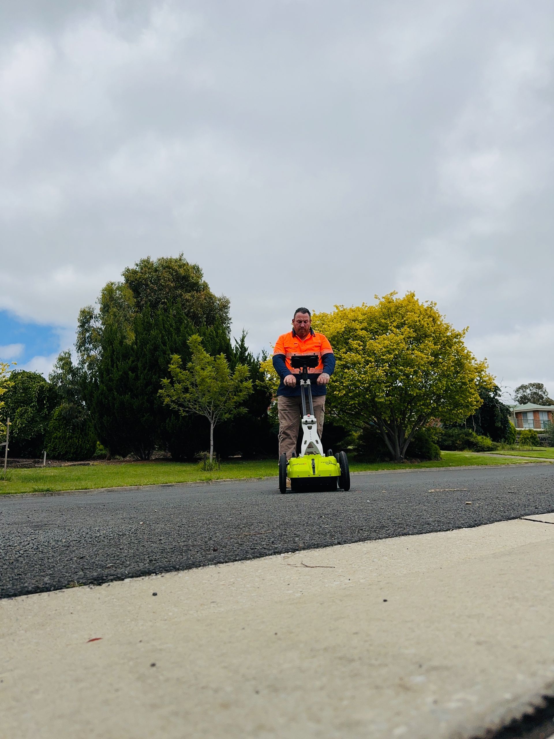
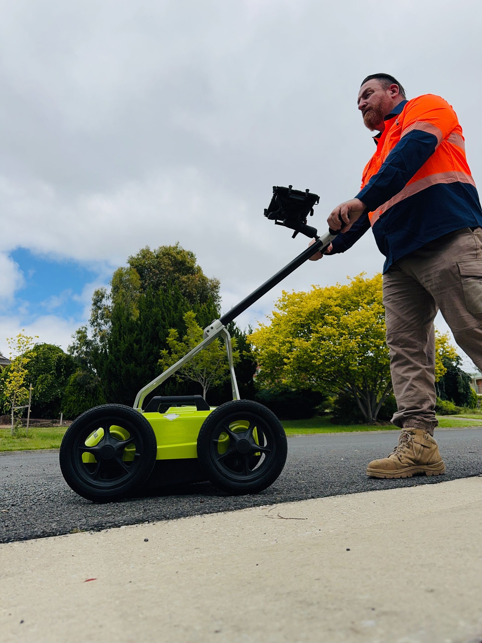
Equipment Used by Pulse Locating Services


Pulse Locating Services employs cutting-edge equipment to ensure precise and efficient pipe location. One of the primary tools used is Ground Penetrating Radar (GPR). GPR works by emitting radar waves into the ground and detecting reflections from subsurface structures, including pipes. This technology enables Pulse Locating Services to visualise underground pipes and accurately determine their location and depth.


Benefits of Choosing Pulse Locating Services


Partnering with Pulse Locating Services offers numerous benefits for property owners in need of underground pipe location services:


Expertise: The team at Pulse Locating Services possesses extensive experience and specialised training in underground pipe location. Their expertise ensures thorough and accurate results, giving property owners peace of mind.


Efficiency: Pulse Locating Services utilises advanced technology and efficient methodologies to streamline the pipe location process. Their prompt response and quick turnaround times minimize downtime and disruption to ongoing projects.


Cost-Effectiveness: By preventing damage to underground pipes and infrastructure, Pulse Locating Services helps property owners avoid costly repairs and delays. Their precise detection techniques help minimize excavation and repair costs, ultimately saving time and money.


Conclusion

In conclusion, finding underground pipes is a critical step in any construction or excavation project. By enlisting the services of a professional underground pipe locator like Pulse Locating Services, property owners can ensure the safety, accuracy, and efficiency of their projects while minimising risks and costs associated with underground infrastructure damage.


By taking proactive measures to locate and protect underground pipes, property owners can safeguard their investments and ensure the integrity of their infrastructure for years to come.

Image depicts Warren Eeles from Pulse Underground Location Services, using Ground Penetrating Radar
By Pulse Locating Services February 20, 2024
Understanding what to expect when engaging an Underground Service Locator. The article outlines what an Underground Locator is and highlights other terms of which they are commonly referred to. It outlines the techniques and types of equipment a service locator will employ and offers a few tips on what you can do the may assist in reducing your overall costs.
Image depicts an unmarked grave with up to 10 unmarked headstones.
By Pulse Locating Services February 4, 2024
Outlining the benefits of Ground Penetrating Radar (GPR) and how it maybe utilised in the works around locating unmarked graves. Moreover, it discusses the limitations of GPR for grave detection but also how to harness modern technology for such purposes.
Image depicts a utility locator pushing GPR.
By Pulse Locating Services December 1, 2023
Deciphering Utility Mapping: Navigating Beneath the Surface Utility mapping, a cornerstone of modern infrastructure management and urban planning, is a methodical process aimed at accurately charting and cataloguing underground utilities and infrastructure. As our cities grow and evolve, the need to understand what lies beneath the surface becomes increasingly critical. In this article, we'll delve into the intricacies of utility mapping, its significance, and the technologies driving its evolution. Understanding Utility Mapping Utility mapping involves the systematic identification, location, and documentation of underground utilities such as water pipes, sewer lines, gas mains, electrical cables, and telecommunication networks. By creating detailed maps and records of these essential assets, utility mapping facilitates informed decision-making, reduces the risk of damage during construction and excavation, and enhances the overall efficiency of infrastructure management. The Significance of Utility Mapping The importance of utility mapping cannot be overstated, particularly in densely populated urban areas where underground utilities crisscross beneath streets, sidewalks, and buildings. Accurate mapping helps utility companies, city planners, engineers, and construction firms avoid costly and potentially dangerous conflicts with buried infrastructure. Additionally, utility mapping plays a vital role in emergency response efforts, allowing first responders to quickly locate and access critical utilities during emergencies such as gas leaks or water main breaks. Technologies Driving Utility Mapping Advancements in technology have revolutionised the field of utility mapping, enabling more efficient and precise data collection, analysis, and visualisation. Some of the key technologies driving utility mapping include: Ground Penetrating Radar (GPR): GPR uses radar pulses to penetrate the ground and detect subsurface features, including buried utilities. This non-destructive method provides high-resolution images of underground infrastructure, making it an invaluable tool for utility mapping projects. Electromagnetic Locators: Electromagnetic locators detect the electromagnetic fields generated by buried utilities, allowing operators to trace their paths and accurately map their locations. Geographic Information Systems (GIS): GIS software enables the storage, analysis, and visualisation of spatial data, including utility maps. By integrating utility mapping data with other geographic information, GIS helps stakeholders make informed decisions about infrastructure planning and management. Benefits of Utility Mapping The benefits of utility mapping are far-reaching and multifaceted: Risk Mitigation: By accurately mapping underground utilities, utility mapping helps identify potential conflicts and hazards before construction or excavation begins, reducing the risk of accidents, injuries, and costly delays. Cost Savings: Avoiding damage to buried utilities saves money on repairs, downtime, and legal liabilities. Additionally, efficient infrastructure planning and maintenance based on accurate mapping data can optimise resource allocation and minimise operational costs. Enhanced Resilience: In an increasingly interconnected world, resilient infrastructure is essential for maintaining essential services and ensuring public safety. Utility mapping contributes to resilience by providing the information needed to plan for and respond to emergencies effectively. Utility mapping is a fundamental component of modern infrastructure management and urban planning. By accurately charting underground utilities and infrastructure, utility mapping improves safety, efficiency, and resilience while reducing costs and mitigating risks. As technology continues to advance, utility mapping will play an increasingly vital role in shaping the cities of tomorrow and ensuring they remain safe, sustainable, and liveable for generations to come.